The leak you see is rarely above the water that caused it
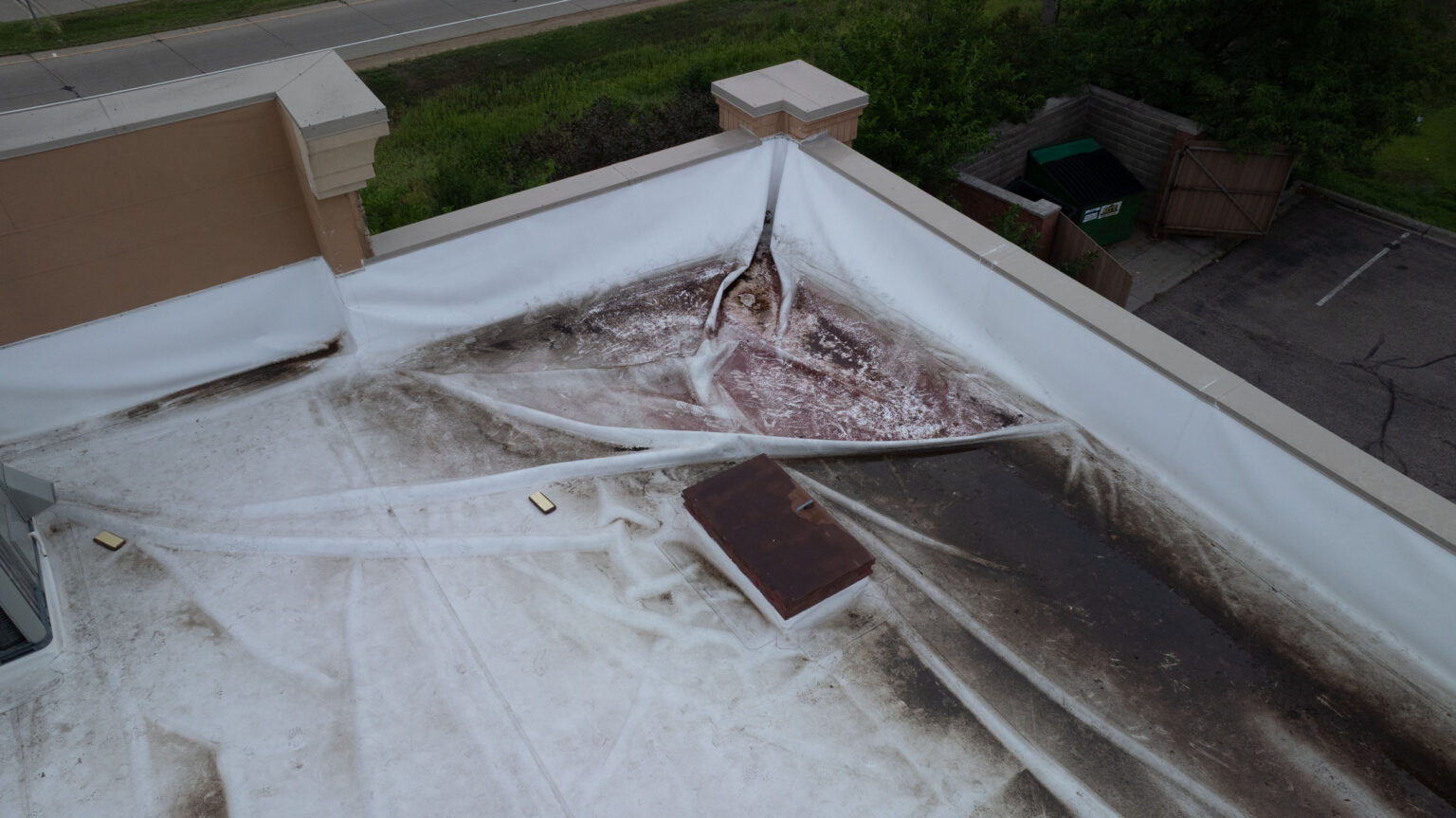
On a 90,000-square-foot distribution roof along the Interstate 64 corridor or out near the industrial flats at Institute, the stain on a tenant's ceiling almost never sits directly under the breach. Water gets in at a failed lap, then runs sideways under the membrane and along the deck flutes until it surfaces twenty or forty feet away. Two people pacing that roof for an afternoon will find the obvious split and walk right over the saturated bay that is feeding it. We fly these roofs instead, and we fly them with a thermal camera, because the real problem is heat retention in wet insulation, not anything the eye can pick out from the surface.
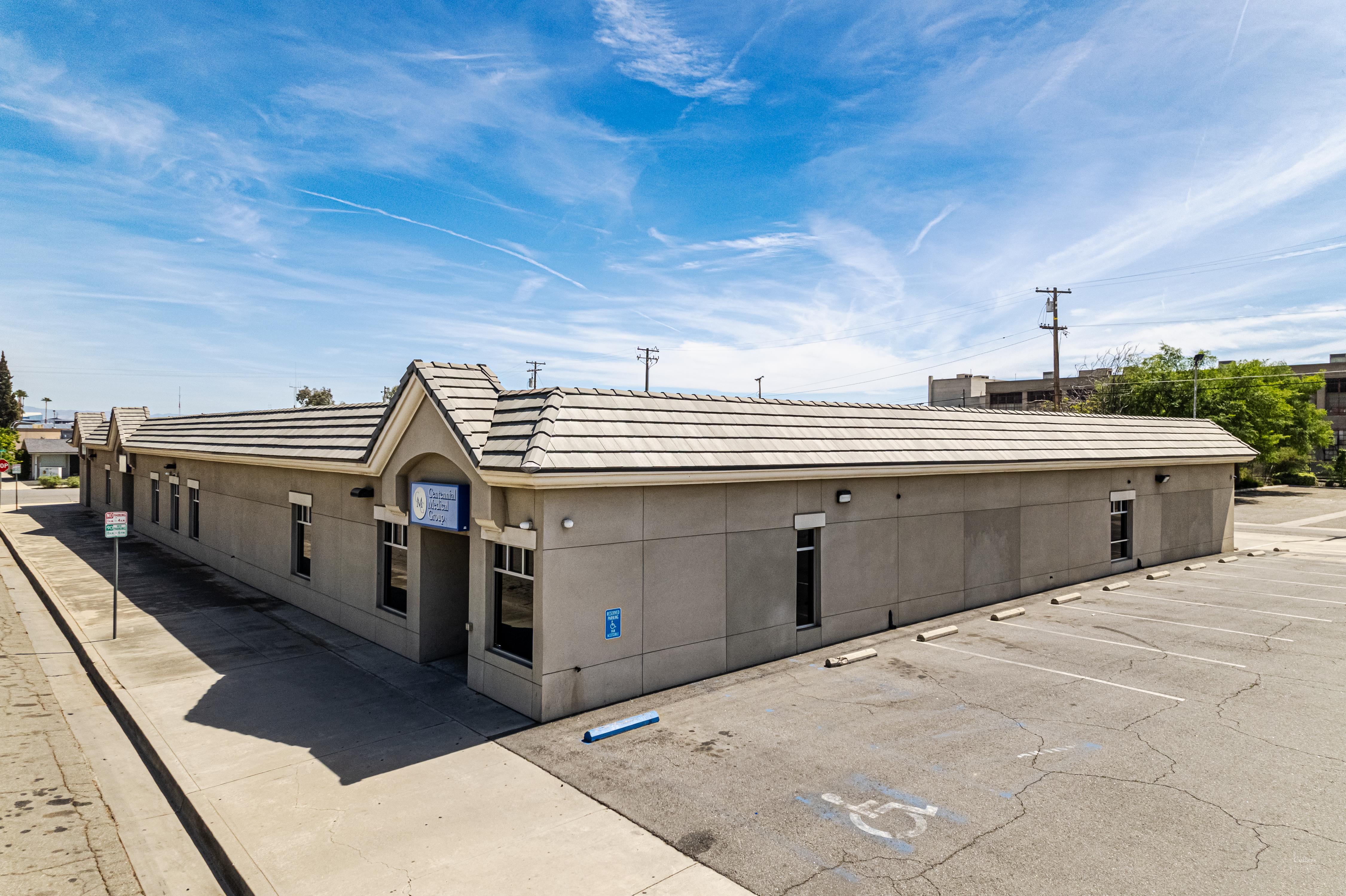
An aerial survey covers a large Charleston commercial roof in a fraction of the time a walkover takes, holds a fixed altitude so every frame shares one scale, and captures the whole field in a continuous record - all without sending anyone onto a roof whose structural and surface condition is still an unknown. For an owner deciding between repair, recover, and full replacement, that complete and consistent picture is the difference between a hunch and a defensible scope.
Why thermal is the part that matters
The most valuable thing an aerial inspection produces is a moisture map of the insulation hidden under the membrane. Wet insulation holds the day's solar heat longer than the dry board around it, so after sundown the saturated areas glow in infrared while the surface above them reads as perfectly intact in visible light. We deliberately schedule the thermal pass for the cool-down window after sunset, when that temperature differential is sharpest and the wet zones light up against the dry deck.
That single map drives the most expensive decision on the entire roof:
- Isolated wet pockets point toward cut-and-patch repair with targeted insulation replacement.
- Scattered but contained saturation can favor a recover over a still-sound substrate.
- Widespread wet insulation usually means the assembly is finished and a tear-off is the honest call.
This cannot be done well on foot
A trustworthy thermal survey needs uniform, systematic coverage of the whole field inside a narrow post-sunset window. Walking an infrared camera across a roof that size, in that little time, at a consistent height and angle, simply does not happen reliably. The aerial platform is what makes the moisture map credible enough to write a specification against.
FAA rules and flying over Charleston in particular
We fly commercially under FAA Part 107, with a certificated remote pilot in command on every flight, and that framework carries more weight here than in most markets. Yeager Airport sits on a leveled mountaintop directly above the city, and its controlled airspace reaches over a real share of the Charleston and Kanawha City rooftops we get asked to inspect. Flying those jobs legally means securing LAANC authorization or a manual waiver before the drone leaves the case, and respecting the altitude ceilings that come attached to it.
The river valley adds its own wrinkles. Wind funnels and gusts between the hills along the Kanawha, and ridgeline turbulence off the airport bluff can ground a flight on a day that feels calm at street level. We brief airspace and weather before we mobilize so you are not paying for a crew that cannot legally or safely launch. Holding a clear visual line of sight across a sprawling multi-building campus is a planning constraint we resolve in advance, not a surprise discovered on site.
Documentation an adjuster will actually accept
After a hailstorm crosses the Kanawha Valley or a straight-line wind event lifts membrane along a roof edge, the aerial record becomes a claims tool. We produce GPS-tagged imagery showing hail-impact density across the field, wind-displacement patterns at the perimeter, and damage to rooftop units and flashings, formatted to the documentation standard commercial property carriers expect. Because the entire roof is captured in one consistent pass, an adjuster can review the full extent remotely instead of relying on a handful of ground-level snapshots.
Where drone inspection earns its keep
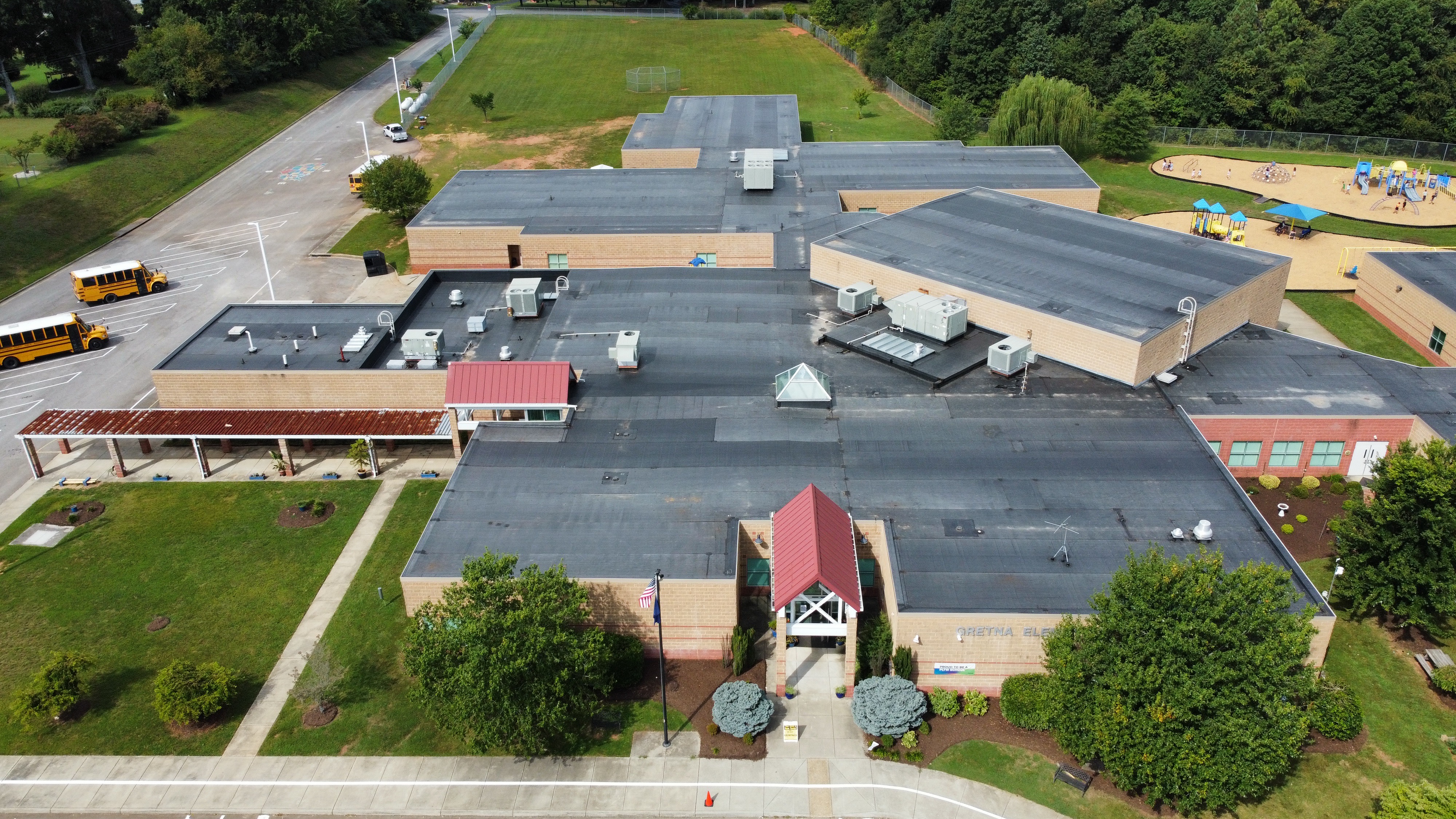
- Large low-slope roofs over warehouses, plants, retail centers, and school or hospital campuses.
- Post-storm claim documentation that has to be turned around quickly and credibly.
- Pre-design surveys that confirm roof area, locate every penetration and curb, and head off the change orders that come from guessing at existing conditions.
It earns less on small or steeply pitched roofs, where a careful manual inspection is fast and thorough on its own. For any commercial roof much past ten thousand square feet, though, the aerial-plus-thermal approach beats boots on the membrane on both speed and completeness.
How a flight is actually run
A useful survey is not someone hovering a camera and eyeballing the roof. We fly a programmed grid with heavy image overlap so the field is captured edge to edge with no gaps, and we hold a fixed altitude so every frame shares the same scale. That discipline is what lets us stitch the imagery into a single georeferenced map an owner can measure off of, instead of a folder of disconnected photos that prove nothing about extent.
The thermal half has its own setup. The infrared sensor is referenced before the pass so the differentials we read mean something, and we log ambient conditions, recent rainfall, and time since sunset, because all three change how saturated insulation reads against dry board. A wet-out from that morning's rain will throw a false signature if the operator does not account for it - which is exactly why we treat the conditions log as part of the deliverable, not an afterthought.
Findings tied to a coordinate you can return to
Because the map is georeferenced, a wet bay we flag in June can be re-flown next spring and compared against the same coordinates to see whether the saturation is spreading. That turns a one-time inspection into a baseline and hands a facilities manager hard evidence for a capital request, rather than a vague sense the roof is getting worse.
Where the data lives after the flight
For owners running several buildings across the Charleston metro, the real payoff of aerial inspection shows up over years, not in a single report. We can fold the imagery and moisture maps into a roof asset record so each building carries a documented condition history, square footage, penetration count, and a tracked list of open defects. When budget season comes around, that record is what separates the roof that genuinely needs replacement money from the one that can be nursed another two seasons with targeted repairs.
It also sharpens warranty and leak disputes. A dated, georeferenced image of a flashing failure or a wind-lifted edge gives an owner a defensible record of when a condition first appeared, which matters when a manufacturer or a prior contractor is asked to stand behind their work. We hand that documentation over in a form the owner keeps, not one locked inside our office.
What you get, and how fast
A standard engagement delivers the visible-light photo record of the full roof, the post-sunset thermal moisture map, a marked plan of the findings, and a recommendation on repair versus recover versus replacement. When the inspection supports an insurance claim, the deliverable is built to drop straight to the adjuster, and we can provide a written interpretation of the imagery if a claim turns contested.
Routine surveys in the Charleston area generally schedule within a few business days. Storm-response flights for active claims move to the front of the line once airspace and weather allow, often within a day or two of the event. If you manage a large roof anywhere from Downtown Charleston out to the Putnam County warehouse belt and you are tired of paying for walkovers that miss the real problem, call 304-964-6618 or email quotes@commercialrooferswestvirginia.com to put a flight on the calendar.
Q&A
Questions about Drone & Thermal Roof Inspection for Charleston, WV Commercial Buildings
What decides the next roof step?
Moisture risk, membrane condition, drainage, access, roof traffic, rooftop equipment, age, warranty language, and building operations all shape the recommendation.
Can the building stay open during the work?
Often yes. The scope needs daily dry-in planning, staging notes, tenant protection, safety controls, and access limits written before field work starts.
What should ownership send before a roof walk?
Useful items include leak photos, prior proposals, roof plans, warranty paperwork, roof age, interior leak locations, and the best contact for roof access.
Related Roof Decisions
PVC Commercial Roofing in West Virginia
The first clue on PVC Commercial Roofing is often not the leak mark; it is the route water took between I-64 and I-77 split and Sissonville. We trace seams, drains.
→
Roof Tear-Off and Replacement in West Virginia
Budgeting Roof Tear-Off and Replacement around CAMC General starts with constraints that are easy to miss from a satellite view. Rooftop units, parapet height.
→
Insurance Claim Coordination in West Virginia
A leaking curb, open seam, or loose coping cap around Elk City tells only part of the story for Insurance Claim Coordination. We still need to see the drain layout.
→
School and K-12 Educational Building Roofing in West Virginia
Kanawha County Schools, the largest school district in West Virginia serving over 27,000 students across more than 50 campuses in and around Charleston, faces.
→